Intec Marketing Services is the authorised reseller for Emlid’s Reach M+/M2  GNSS reciever in Malaysia.

RTK GNSS modules

for UAV mapping

Positioning with centimeter accuracy in RTK and PPK.
For precise UAV mapping with less GCPs

REACH M+

Single-band
Baseline up to 20 km
Update rate: 14 Hz / 5 Hz

RM1,170.00

REACH M2

Multi-band
Baseline up to 100 km 
Update rate: 20 Hz / 10 Hz

RM1,980.00

PPK mapping with centimeter accuracy. Use fewer GCPs

Why camera synchronization is so important

Usually autopilot triggers the camera and records the coordinate it has at that moment. When the drone is flying at 20 m/s and GPS works at 10 Hz, that means your autopilot will have position readings only each 4 m, which is not suitable for precise georeferencing. In addition, there is always a delay between the trigger and the actual moment the photo is taken.


Reach eliminates the delay

Reach solves the problem of positioning by connecting directly to the camera hot shoe port, which is synced with the shutter. The time and coordinates of each photo are logged with a resolution of less than a microsecond. This method allows GCPs to be used only to check your accuracy.

1. Connect Reach to a hot shoe port on a camera

Every time a photo is taken camera produces a pulse on a flash hot-shoe connector which is synced to a shutter opening.
2. Fly a drone, Reach will record photo events

Reach captures flash sync pulses with sub-microsecond resolution and stores them in a raw data RINEX log in the internal memory.
3. Download logs from Reach and base station

After the flight, get the RINEX logs from your airborne Reach module and a base station (Reach RS, CORS or another receiver).
4. Process logs and get a file with geotags of photos

Process RINEX files using free RTKLIB software. The produced file with precise coordinates of the photos can be used for georeferencing.

NTRIP or another Reach as a base station

To calculate centimeter-precise coordinates in PPK and RTK, Reach needs corrections from a base station. It could be either another Reach receiver or an NTRIP service. VRS is also supported.


Compatibility

Reach M2 and M+ work seamlessly with other Reach receivers over any link and are compatible with any other receiver that supports RTCM3 and NTRIP.

Choosing between Reach M+ and Reach M2

Reach M+ and Reach RS+

If you work within short baselines then Reach M+ is an optimal choice.

RTK

Up to 10 km

PPK

Up to 20 km

Time to get fix

1-2 min

Frequency bands

Single-band

RINEX logging update rate

Up to 14 Hz

Reach M+ UAV mapping kit
Reach M+, Reach RS+ and GNSS antenna

RM4,800.00

Choosing between Reach M2 and Reach RS2

 Reach M2 and Reach RS2

Provides robust performance and quick initialization. Allows working on long baselines.

RTK

Up to 60 km

PPK

Up to 100 km

Time to get fix

5 sec

Frequency bands

Multi-band

RINEX logging update rate

Up to 20 Hz

Reach M2 UAV mapping kit
Reach M2, Reach RS2 and GNSS antenna

RM10,500.00

Comes with an app

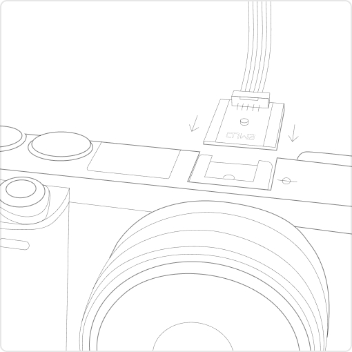
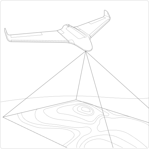
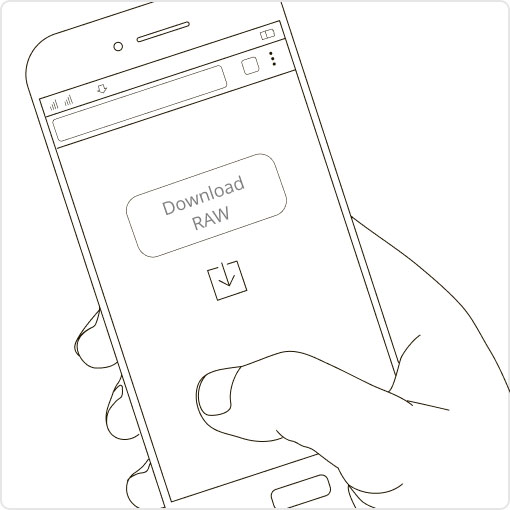
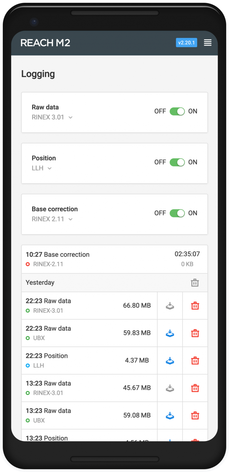
ReachView is the most user-friendly software for data collection that is available both for Android and iOS. With ReachView, you can control all the features of Reach receivers, such as setting up a base station, logging RINEX data, configuring NMEA output, and monitoring data..

Camera control

Reach is able to trigger cameras as well as register events. The event mark feature is a must for aerial mapping as it allows the precise time when the shutter was activated to be registered.

Simple log management

Logs are automatically recorded directly to RINEX in the internal memory. View a list of the logs and download them using the ReachView app.

Monitoring data

ReachView shows current satellite levels, your location on a map, and much more.

Reach

ReachView app and all features of Reach receivers are included

Reach M+ UAV mapping kit
1 x Reach M+
1 x Reach RS+
and accessories

RM4,800.00

Reach M2 UAV mapping kit
1 x Reach M2
1 x Reach RS
and accessories

RM10,500.00

Specifications

Specifications
Reach M2

Mechanical

  • Dimensions 15.4 x 45.3 x 14.6 mm
  • Weight 20 g
  • Operating tº -20…+65 ºC

Electrical

  • Input voltage on USB and JST-GH 4.75 – 5.5 V
  • Antenna DC bias 3.3 V
  • Av. consumption @5V 200 mA

Positioning

  • Static horizontal 4 mm + 0.5 ppm
  • Static vertical 8 mm + 1 ppm
  • Kinematic horizontal 7 mm + 1 ppm
  • Kinematic vertical 14 mm + 1 ppm

Connectivity

  • LoRa radio (sold separately)
  • Frequency range 868/915 MHz
  • Distance Up to 8 km
  • Wi-Fi 802.11b/g/n
  • Bluetooth 4.0/2.1 EDR
  • Ports USB, UART, Event

Data

  • Corrections NTRIP, RTCM3
  • Position output NMEA, LLH/XYZ
  • Data logging RINEX with events with update rate up to 20 Hz
  • Internal storage 16 GB

GNSS

  • Signal tracked GPS/QZSS L1C/A, L2CGLONASS L1OF, L2OFBeiDou B1I, B2I Galileo E1-B/C, E5b
  • Number of channels 184
  • Update rates 10 Hz GNSS
  • IMU 9DOF

Specifications
Reach M+

Mechanical

  • Dimensions15.4 x 45.3 x 14.6 mm
  • Weight20 g
  • Operating tº-20…+65 ºC

Electrical

  • Input voltage on USB and JST GH4.75 – 5.5 V
  • Antenna DC bias3.3 V
  • Av. consumption @5V200 mA

Positioning

  • Static horizontal 5 mm + 1 ppm
  • Static vertical 10 mm + 2 ppm
  • Kinematic horizontal 7 mm + 1 ppm
  • Kinematic vertical 14 mm + 2 ppm

Connectivity

  • LoRa radio (sold separately)
  • Frequency range 868/915 MHz
  • Distance Up to 8 km
  • Wi-Fi 802.11b/g/n
  • Bluetooth 4.0/2.1 EDR
  • Ports USB, UART, Event

Data

  • Corrections NTRIP, RTCM3
  • Position output NMEA, LLH/XYZ
  • Data logging RINEX with events with update rate up to 14 Hz
  • Internal storage 8 GB

GNSS

  • Signal tracked GPS/QZSS L1, GLONASS G1, BeiDou B1, Galileo E1, SBAS
  • Number of channels 72
  • Update rates 14 Hz / 5 Hz
  • IMU 9DOF

Tell me more