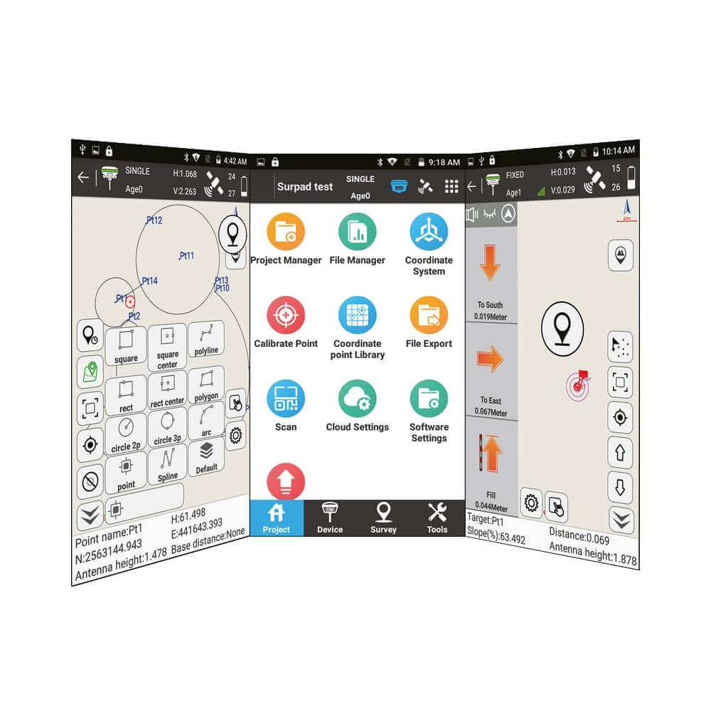
GIntec Surpad 4.0
Developed after years of market experience and feedback from the international geospatial community, Surpad 4.0 is Gintec’s latest all-in-one GIS data collector with integrated GNSS RTK control. The software is Android-based and features CAD synchronization capabilities, road design and layout functions, and an intuitive GUI for both the “basic” and “advanced” user. Surpad 4.0 comes free with every Gintec GNSS receiver but works seamless with other major receivers in the market, providing fast communication and complete control of the receiver from the software itself.
Features
- Customizable interactive UI
The intuitive icon-style interface and concise function classification allows even first-time users to understand how the work the software easily. Tweak to interface according to your preference – choose between chart or list style, customize quick menus, and much more.
- Flexible function selection
“Advanced” users can turn on and off various survey functions software to fit their preferred workflow for increased efficiency on-site.
- Integrated worldwide coordinate systems
Comes built in-in with more than 1600 coordinate reference systems worldwide. The software also has the ability to have custom defined coordinate systems and localization.
- Google Maps and geo-referenced map background
Load in Google Maps or other geo-referenced maps or CAD layers into the survey screen background to grasp a better idea of the site and keep track of the data captured.
- Graphical marking and photographic documentation of collection points
Mark and annotate survey points with various point conditions, such as the time interval-based “Auto Point” function and long averaging “Control Point” function. Add important site details to collection points using the photo and sketch function.
- Enhanced stakeout capabilities
Point or line stakeout is made easier on site with the voice and visual guidance system, as well as a controlled approach audio signal to help improve user efficacy.
- CAD function with real-time acquisition
Supports 2D and 3D CAD files, and real-time acquisition. Create maps in the field, add CAD text, calculate angles and areas, as well as import and export DXF files.
- Specialised functions for road, aerial cables, and railway
Specialised functions for professional road construction like stakeout, section, slope, and abutment conical slope lofting. Other special functions include dedicated electrical lines survey and railway stakeout. Import design files from industry standard file formats.
- Support for 3rd party GNSS receivers and total stations
Connect, survey, and stakeout with a wide variety of compatible GNSS receivers and total stations, including units from Topcon, Sokkia, High Target, and so much more.
- Support for third generation tilt survey algorithm
Calibrate tilt sensors of compatible GNSS receivers from within the software for <3 cm accuracy tilt survey.
- COGO capabilities
Perform all COGO calculations on the go, including offset, resection, forward intersection, and more.