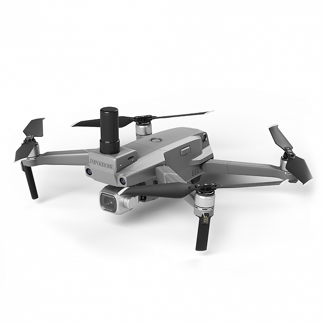
Topodrone DJI Mavic 2 Pro L1/L2 RTK/PPK
Compact drone with 31 minutes of flight, equipped with dual-frequency L1/L2 GNSS RTK/PPK receiver
A modern tool for performing high-precision geodetic aerial photography and topographic and geodetic works – integrated automated solutions based on multi-rotor and aircraft-type geodetic unmanned vehicles.
TOPODRONE solutions:
- They do not require serious piloting skills – all flights are carried out automatically on pre-built missions.
- There is no need to establish and coordinate ground control points – you save time and money when carrying out field work.
- The antenna is located above the center of photography, and also uses the data of the onboard inertial navigation system to take into account the tilt of the antenna during the flight of the drone – this allows for increased accuracy compared to similar solutions on the market
Features
- Affordable professional-grade survey solution
- Automatic survey and stable signal reception
- L1/L2 GNSS RTK/PPK receiver on board
- GNSS receiver integration with a drone camera
- Without intervention in the design of the drone, the manufacturer’s warranty is preserved
- Removable antenna allows the use of a standard shipping case.
- Obstacle detection sensors protect the drone from emergency situations.
- Accuracy up to 3 cm XYZ in post-processing without using reference points
- Support for modern mission planning and execution software (Pix4Dcapture, Map Pilot, GS Pro)
- Photogrammetric Product Support: Agisoft Metashape, Pix4Dmapper, Bentley Context Capture
Includes
- Drone DJI Mavic 2 Pro
- L1/L2 GNSS RTK / PPK receiver integrated with a drone
- External removable GNSS antenna
- Shipping case
- Software for post-processing of GNSS measurements and image geotagging
- Instructions for equipment operation and data processing