Intec Marketing Services is the authorised reseller for Emlid’s Reach RS2 GNSS reciever in Malaysia.

REACH RS2

Multi-band RTK GNSS receiver
with centimeter precision

For surveying, mapping and navigation.
Comes with a mobile app

Baseline up to 100 km
Update rate 10 Hz

RM7,800.00

Gets a fix
in seconds

Reach RS2 gets a fixed solution in just seconds and maintains robust performance even in challenging conditions. Centimeter accuracy can be achieved on distances up to 60 km in RTK, and 100 km in PPK mode.

GPS, GLONASS, BeiDou,Galileo, and QZSS
L1OF, L2OF, L1C/A, L2C,E1B/C, E5b, B1I B2I

PPP
support

RINEX raw data logs are compatible with PPP services so you can now get centimeter-precise results in any place on Earth. Process RINEX files in an online service and get position with absolute accuracy.

Built-in
3.5G modem

Reach RS2 features a power-efficient 3.5G HSPA modem with 2G fallback and global coverage. Now corrections can be accessed or broadcasted over NTRIP independently, without relying on Internet connection on your phone.

22 hours
on 1 charge

Up to 22 hours of autonomous work when logging data and up to 16 hours as a 3G rover, even in cold weather—no more need to carry spare batteries with you. Reach RS2 can charge from a USB wall charger or a power bank over USB-C.

emlid rs2

Surveying
with ReachView

The easiest to use software for data collection that is available both for Android and iOS. With ReachView, you can collect and stakeout points and control all the features of Reach receivers, such as setting up a base station, logging RINEX data, and configuring NMEA output.

Point collection:
create projects, save points,
and export in industry standard formats

Record each position as a point with centimeter precise coordinates. Export projects and open them in GIS or CAD software like AutoCAD, ArcGIS, QGIS, and others.

Formats

DXF, CSV, GeoJSON, ESRI Shapefile

Stakeout:
Find points' position on the ground

Stakeout is used to find exact physical locations of points. They can be collected in ReachView or imported from other CAD or GIS software.

Process of stakeout in ReachView has two steps: map view and bulls-eye. Map’s purpose is to help you navigate to points on long distances. When you get closer than 40 cm to the point, bulls-eye turns on to make it easier for you to visually match receiver and point.

Formats

CSV, DXF and GeoJSONs

Logging in RINEX:
record raw data, position, and base correction logs

Record raw data, position and base correction logs with an update rate up to 10 Hz. Point collection and recording of RAW data are independent processes and can be used simultaneously. ReachView has a simple and intuitive interface for logging configuration and control.

We provide our version of RTKLib for PPK. It’s free and can be downloaded from our docs.

Formats

16 GB

Storage

160 + Days

of logging at 1 Hz

PPP for Opus

RINEX raw data logs are compatible with PPP services so you can now get centimeter-precise results in any place on Earth. Process RINEX files in an online service and get position with absolute accuracy.

Connectivity

Real-time position
streaming in NMEA

Reach provides data in standard NMEA that is used by most GIS apps. Simply connect your device to Reach over Bluetooth or with a cable, and turn on “Position output” in ReachView.

Real-time position
streaming in NMEA

Reach provides data in standard NMEA that is used by most GIS apps. Simply connect your device to Reach over Bluetooth or with a cable, and turn on “Position output” in ReachView.


Compatible apps

MachineryGuide, AgriBus-Navi, Efarmer, Agripilot, and others

 Position streaming

Interfaces

RS-232, TCP, Bluetooth

NTRIP or another Reach as a base station

Reach RS2 needs a base station as a source of corrections. That’s a requirement for centimeter accuracy in RTK and PPK. Base might be either another Reach RS2 receiver or an NTRIP service. VRS is also supported.

Reach RS2 works seamlessly with other Reach receivers over any link.

Input and output corrections

Interfaces

TCP, LoRa, Bluetooth, RS-232, NTRIP

Formats

RTCM3

 Max distance from a base

Over 60 km in RTK 100 km in PPK Any place on Earth with PPP

Engineered to be tough

Reach RS2 is designed to work even in the most challenging environments

IP67

-20ºС…+65ºС

Polycarbonate body

RS2 is waterproof up to 1 m depth. All connectors are completely sealed and protected from water and dust with silicone plugs

We extensively tested Reach RS2 in conditions that simulate coldest winters and hottest summers.

Polycarbonate, an extremely durable material that is used in bulletproof glass, makes Reach RS2 impact-resistant.

Comes with LoRa antenna, USB cable, and carry case with a strap

Reach RS2 is our biggest release since Reach RS

Emlid delivered over 10 000 Reach RS RTK all around the world

From America and Canada to Europe, Africa and Asia. We can’t even count in how many ways people have used Reach RS in their projects. Reach RS and Reach RS+ have given thousands of users all around the world access to centimeter-accurate RTK GNSS measurements.

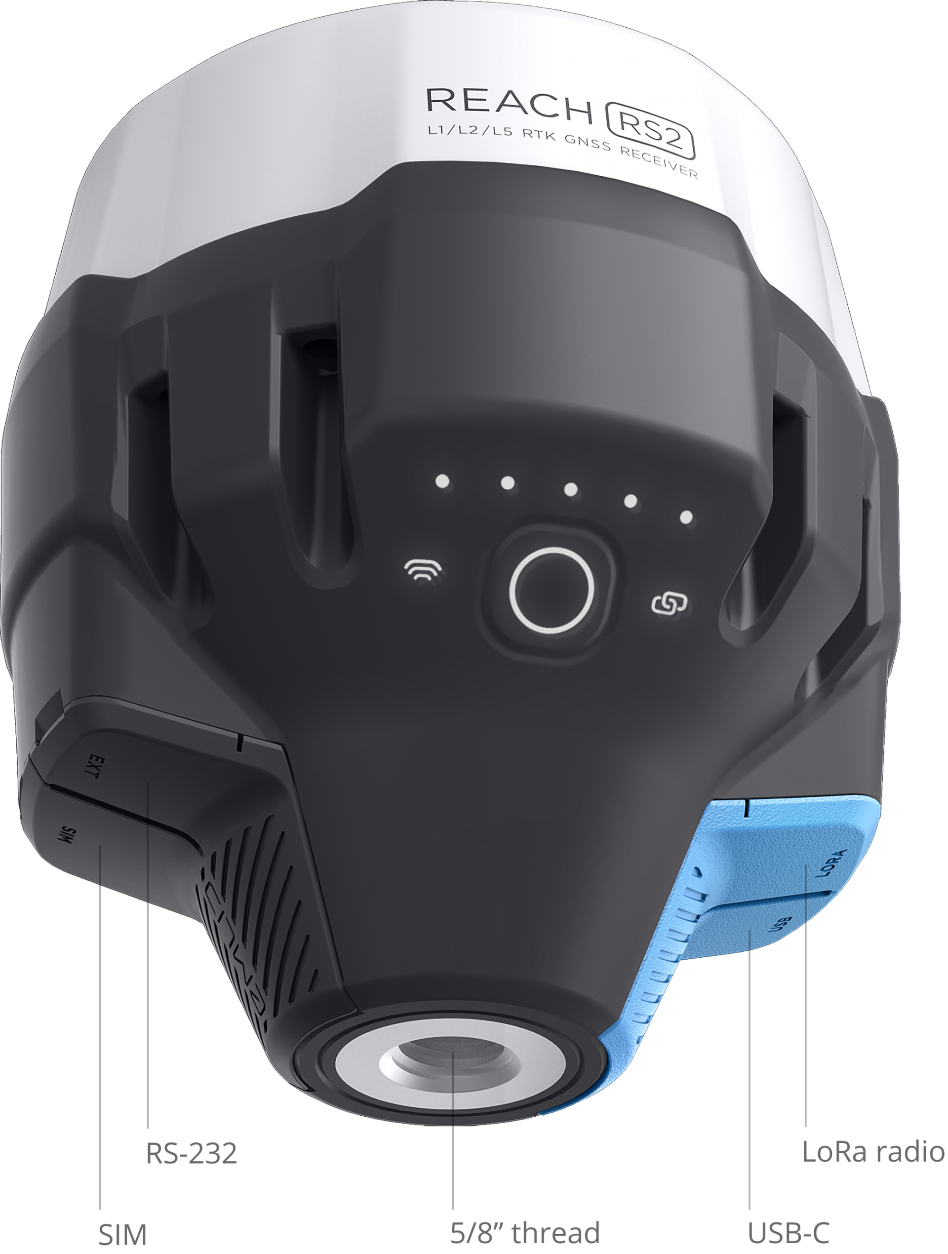
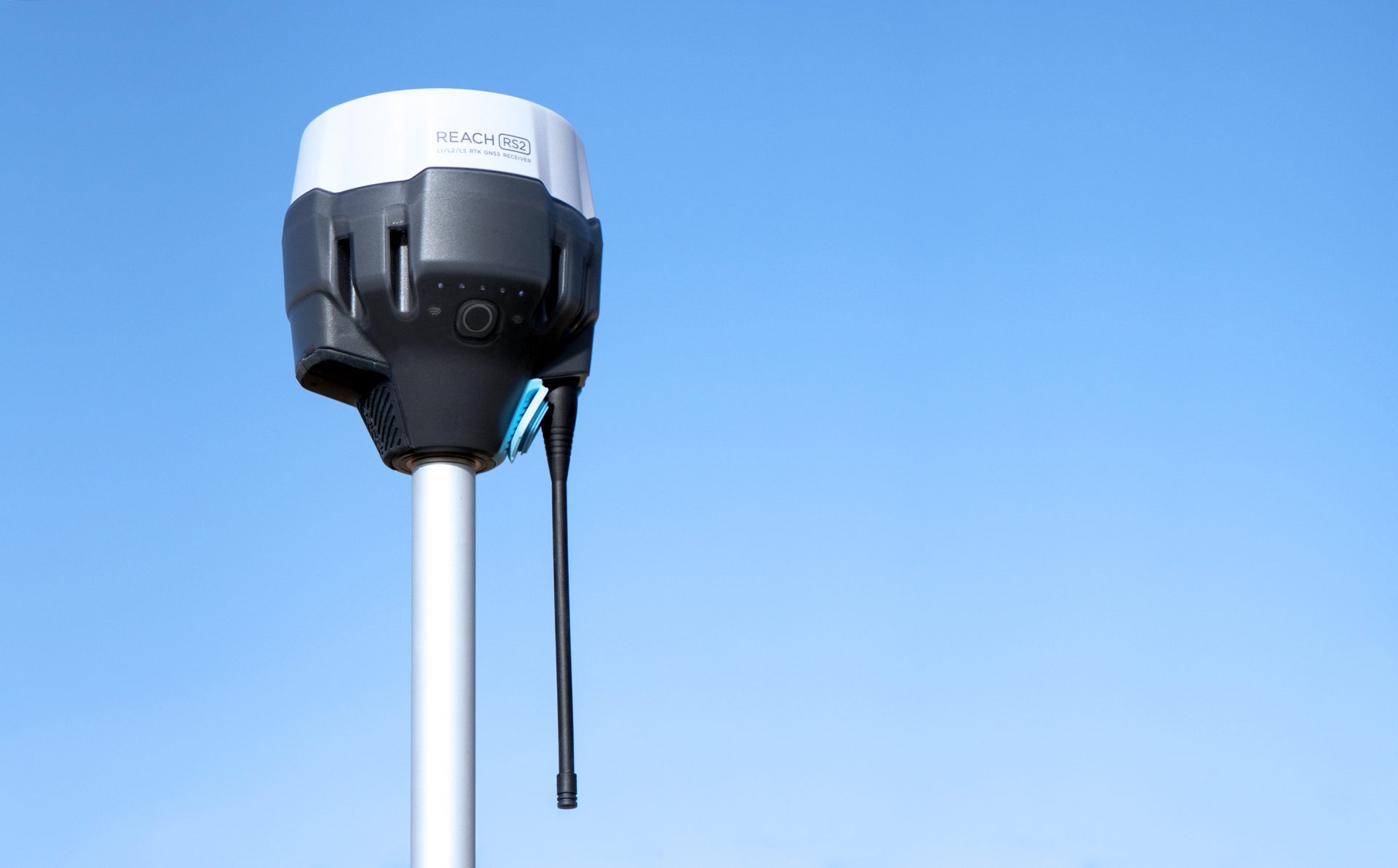
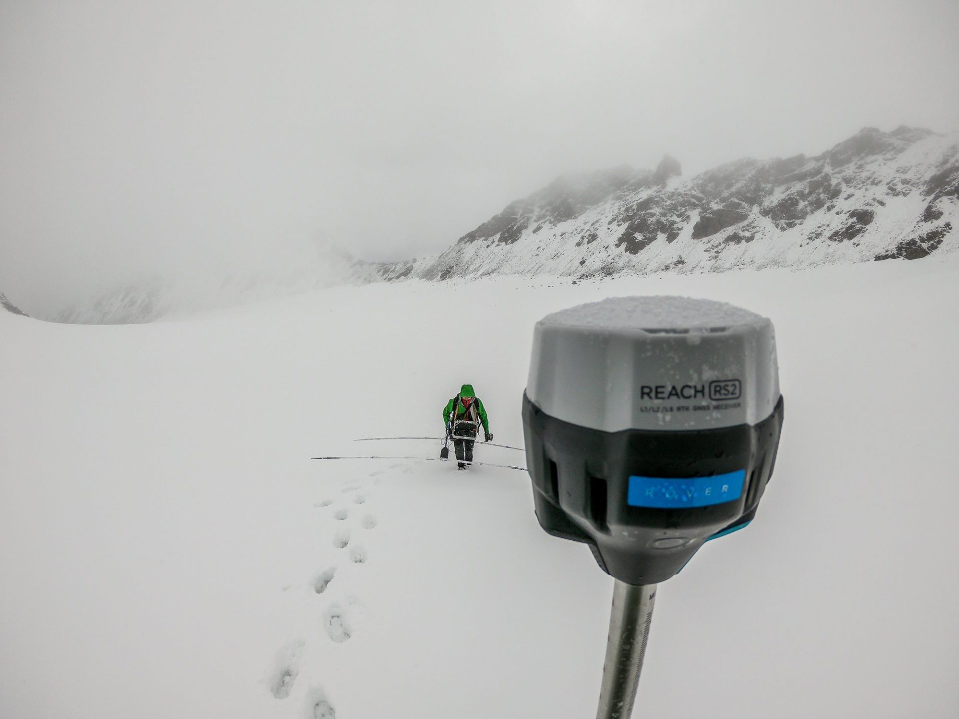
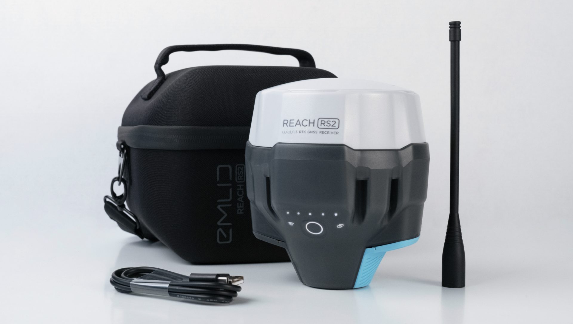
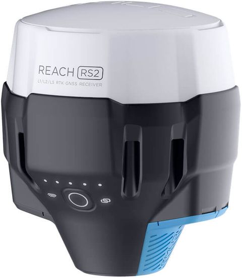
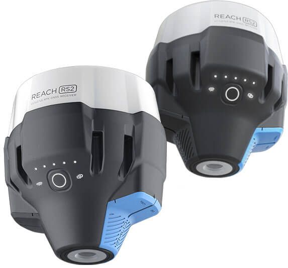
With Reach RS2 we are finally making multi-band receivers affordable

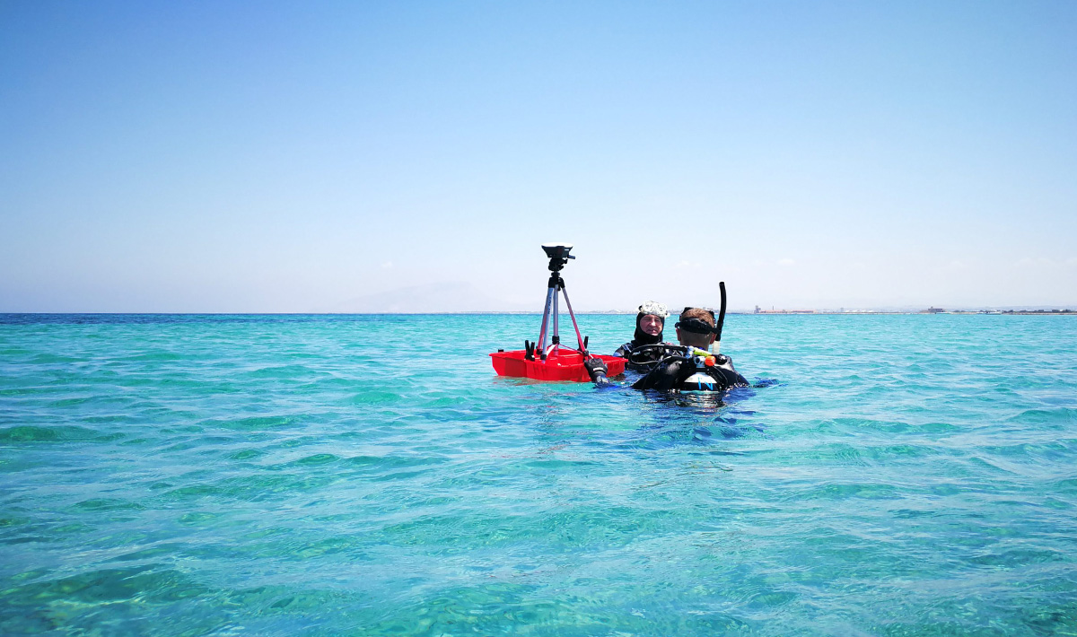
Supporting multiple frequency bands, Reach RS2 fixes 10 times faster, works on longer baselines and supports PPP processing. Reach RS2 can also deliver centimeter accuracy in areas where Reach RS struggled: narrow city streets, forests, and in close proximity to buildings or machinery.

Reach RS2

ReachView app and all features of Reach RS2 are included

Standalone 
1 x Reach RS2 with full package
RM8,500.00


Survey Kit 
2 x Reach RS2 with full packages
RM17,000.00

Specifications

Mechanical

  • Dimensions 126x126x142 mm
  • Weight 950 g
  • Operating tº -20…+65 ºC
  • Ingress protection IP67 (water and dust)

Electrical

  • Autonomy 16 hrs as 3.5G RTK rover,22 hrs logging
  • Battery LiFePO4 6400 mAh, 6.4 V
  • External power input 6–40 V
  • Charging USB Type-C 5 V, 2 A
  • Certification FCC, CE

Positioning

  • Static H: 4 mm + 0.5 ppmV: 8 mm + 1 ppm
  • PPK H: 5 mm + 0.5 ppmV: 10 mm + 1 ppm
  • RTK H: 7 mm + 1 ppmV: 14 mm + 1 ppm
  • Convergence time ~5 s typically

Connectivity

  • LoRa radio
    • Frequency range 868/915 MHz
    • Power 0.1 W
    • Distance Up to 8 km
  • 3.5G modem
    • Regions Global
    • Bands Quad-band, 850/1900,900/1800 MHz
    • SIM card Nano-SIM
  • Wi-Fi 802.11b/g/n
  • Bluetooth 4.0/2.1 EDR
  • Ports RS-232, USB Type-C

Data

  • Corrections NTRIP, RTCM3
  • Position output NMEA, LLH/XYZ
  • Data logging RINEX with events with update rate up to 20 Hz
  • Internal storage 16 GB160+ days of logging at 1 Hz

GNSS

  • Signal tracked GPS/QZSS L1C/A, L2CGLONASS L1OF, L2OFBeiDou B1I, B2I Galileo E1-B/C, E5b
  • Number of channels 184
  • Update rates 10 Hz GNSS
  • IMU 9DOF

Tell me more